Learn about the Reimagined Network
Access Project Documents
Read the Operational Analysis Report, describing METRO’s existing system (as of 2021) when the Reimagine METRO project began.
Read the Transit Development Plan, the final report from the Reimagine METRO planning process.
View the slides from our presentation to the METRO Planning & Rail Committee on 12/14/2022
Read the Title VI Analysis of the Reimagined Network Fixed Route Redesign
The Reimagine METRO Transit Service Plan is being developed to support the goals of METRO’s Strategic Plan.
This page describes the Reimagined Network, the revised plan for METRO’s bus network.
The Reimagined Network
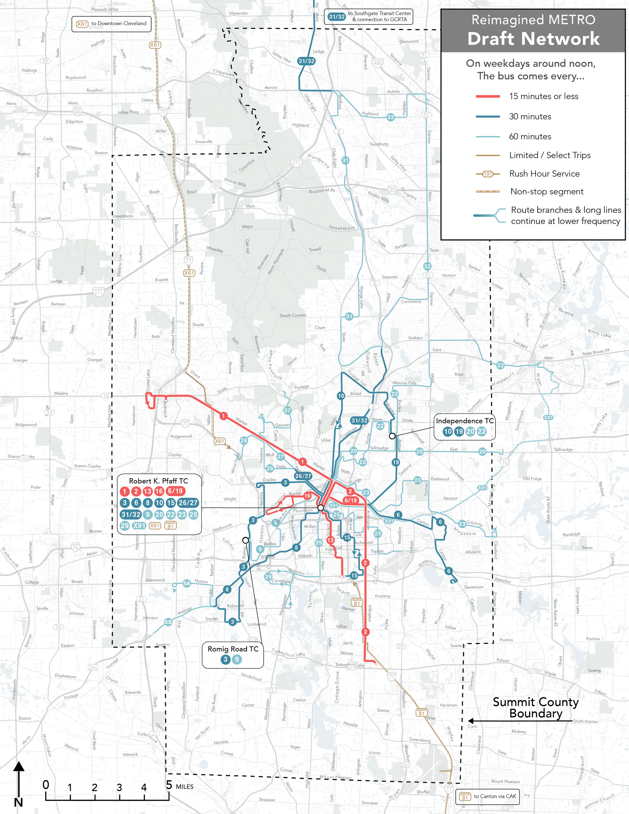
The Reimagined Network is designed to provide frequent and convenient service in high ridership corridors and markets where (and for whom) transit is essential.
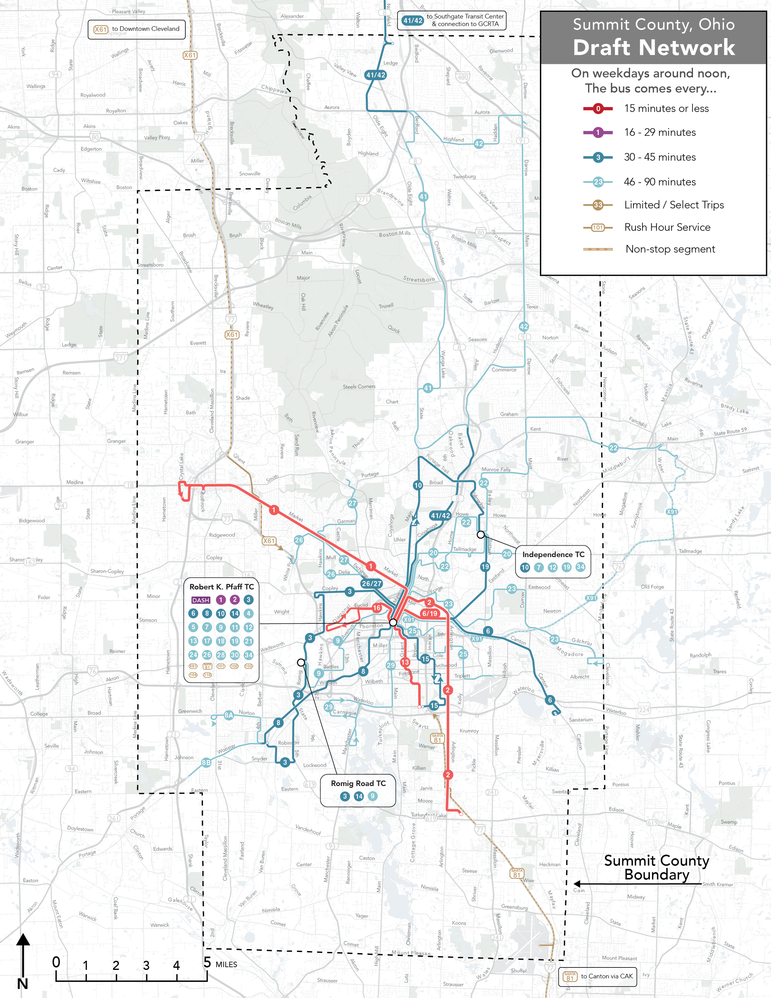
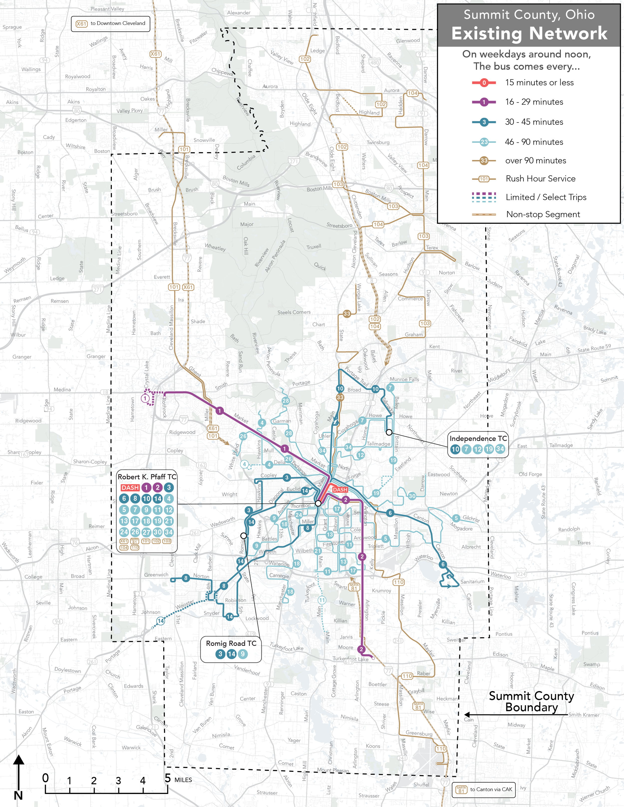
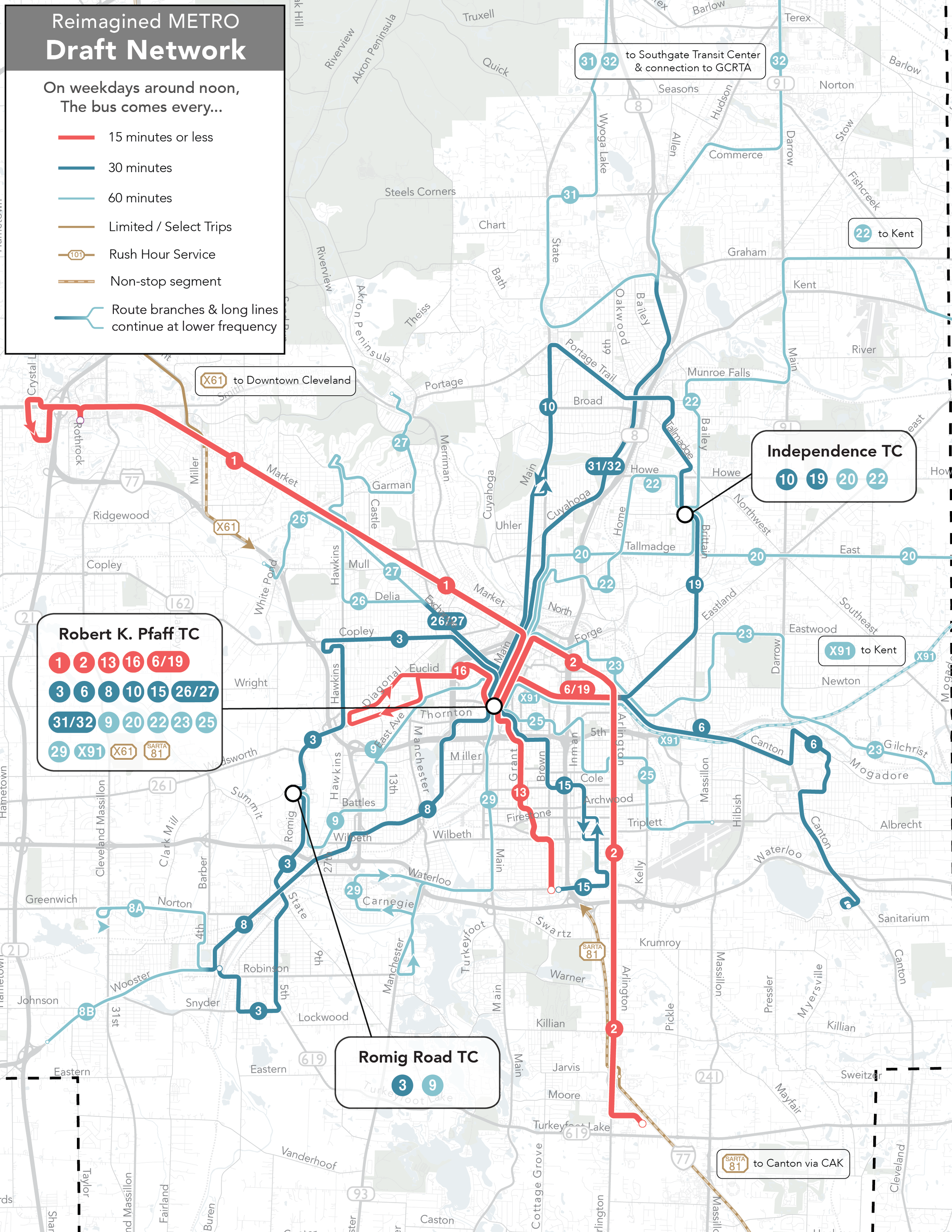
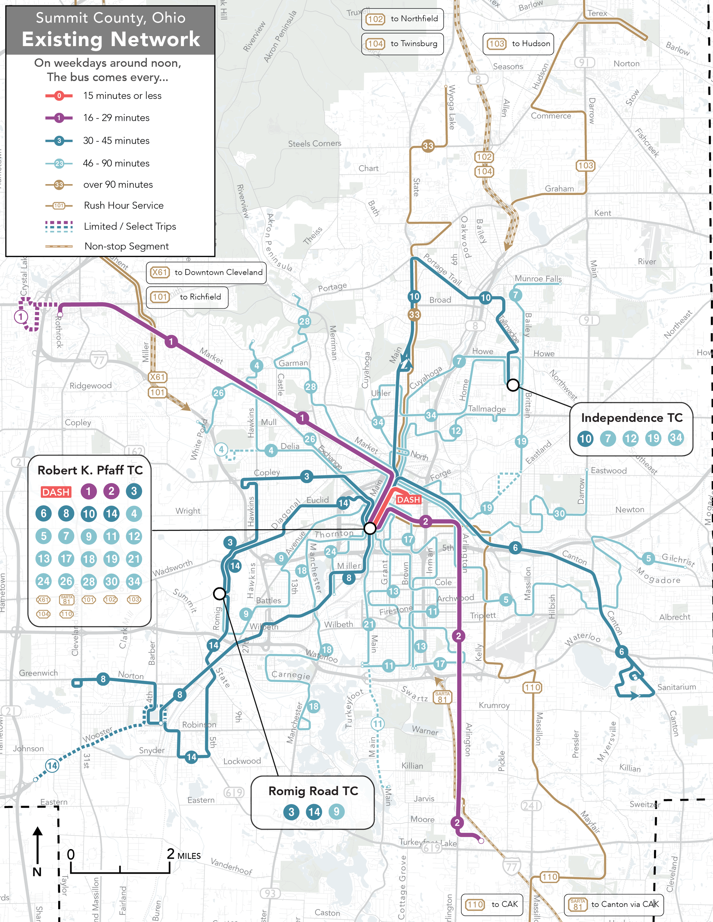
In this map and all frequency maps in this project:
Red lines come every 15 minutes or better. Currently, the only METRO route that meets this standard is the DASH downtown circulator, which runs every 10-15 minutes.
Purple lines run every 16-29 minutes.
Dark blue lines run every 30-45 minutes. All lines shown in this color on this map run every 30 minutes.
Light blue lines run every 46 minutes or more.
Brown lines offer a limited number of trips throughout the day.
CLICK ON THE MAP TO TOGGLE BETWEEN THE REIMAGINED NETWORK AND METRO’S EXISTING NETWORK
The key features of the Reimagined Network include:
Five high frequency routes in Akron. Each of these routes would run every 15 minutes from approximately 6 am until 7 pm
Route 1-West Market: Existing service along West Market Street is upgraded from 20 to 15 minute service.
Route 2-Arlington: Existing service along Arlington Road is upgraded from 20 to 15 minute service.
Route 13-Grant: serving South Akron and Firestone Park.
Route 16-Euclid: serving West Akron.
Additionally, Route 6 and Route 19 would be designed to offer a combined 15-minute frequency along East Exchange near the University of Akron.
Three enhanced 30-minute services in Cuyahoga Falls (Route 31/32), Southeast Akron (Route 15) and Goodyear Heights (Route 19) upgrade existing routes that run only once an hour.
Intercity Routes 41 and 42 serve northern Summit County. These routes would serve GCRTA’s Southgate Transit Center in Cuyahoga County every 30 minutes.
New intercity Route X91 provides hourly service between Akron and Kent via I-76. Route 22 would also be extended to Kent from METRO’s Independence Transit Center.
Reimagined Network Service Levels
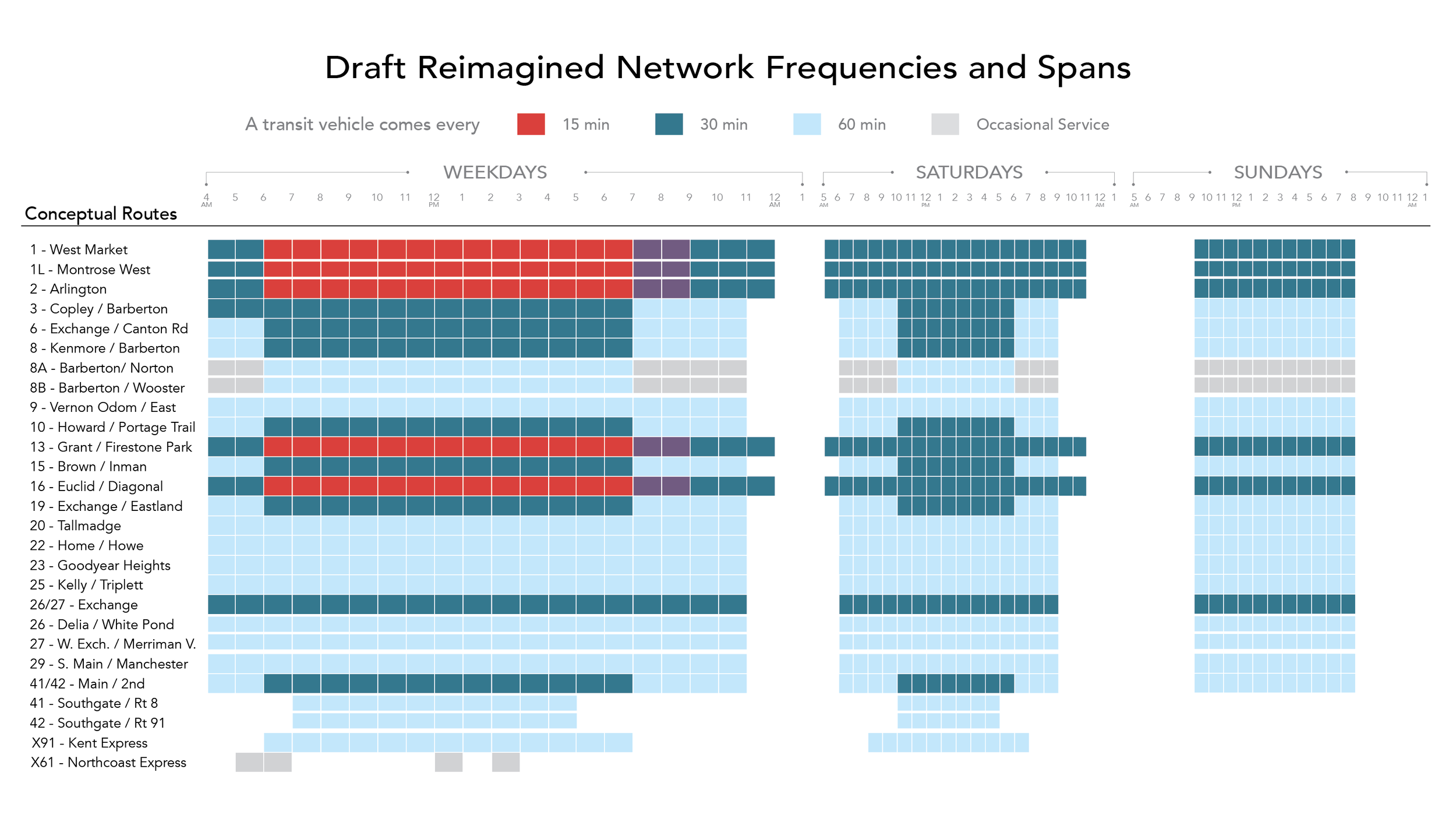
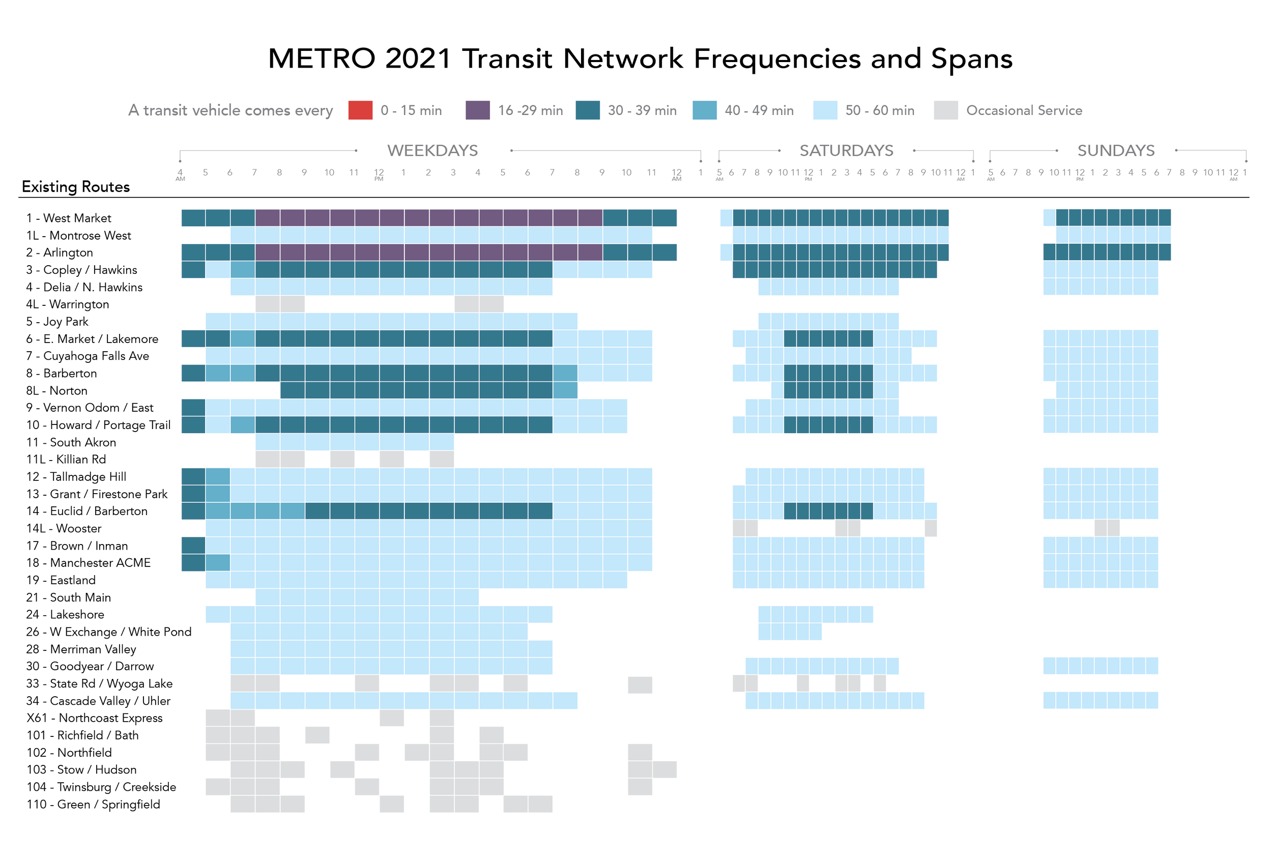
The Reimagined Network invests in high frequency routes, and expands the number of 30-minute services available on weekdays and Saturdays. The images below summarize the frequency of service that would be available on each route during each hour of the day. You can toggle the viewer to compare the Reimagined Network to METRO’s Existing Network.
The frequency and span of service on each route are more consistent compared to the Existing Network. In most cases, routes run from 4 am to 12 pm on weekdays, from 5 am to 11 pm on Saturdays, and from 9 am to 8 pm on Sundays.
Weekend Service
The frequent network routes run every 30 minutes on Saturday and Sunday. 30-minute routes (shown in dark blue routes in the map) would run every 30 minutes on Saturdays, and every hour on Sundays.
Most hourly routes run every hour on Saturdays and Sundays, with the exception of the 41, 42 and X91, which would operate a more limited span of service on Saturday and not run on Sunday.
What did we hear from the public?
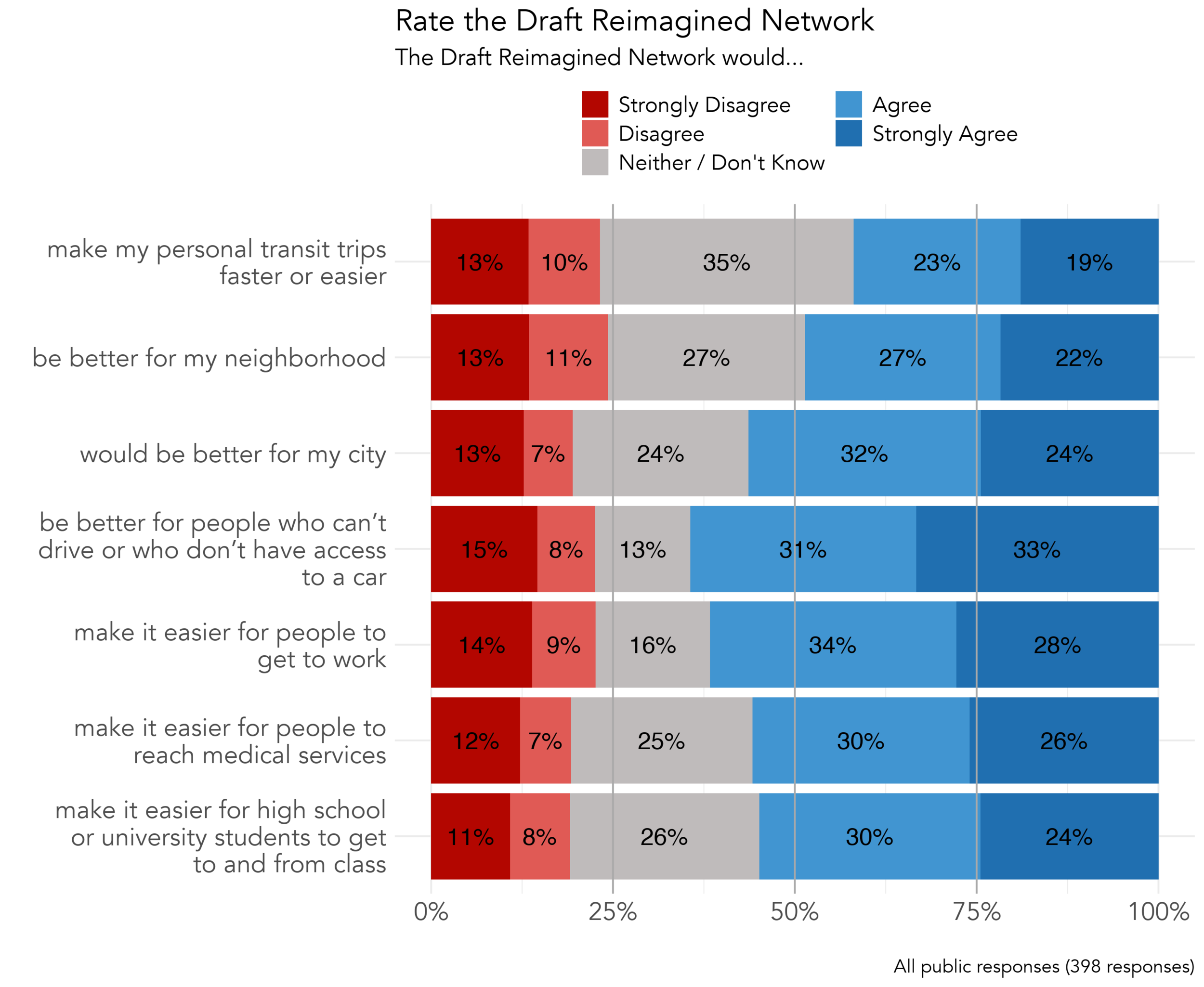
In Fall 2021, the first draft of the Reimagined Network was presented to the public. In a public survey completed by 398 people, respondents were asked to rate the Draft Reimagined Network based on a number of statements about how it could change travel around Summit County, and weigh in on whether it looked like the right balance of high frequency and coverage service.
In the rating questions, the largest portion of respondents agreed that the Draft Reimagined Network would make their personal transit trips faster and be better for their neighborhood. A majority of respondents agreed with the remaining statements.
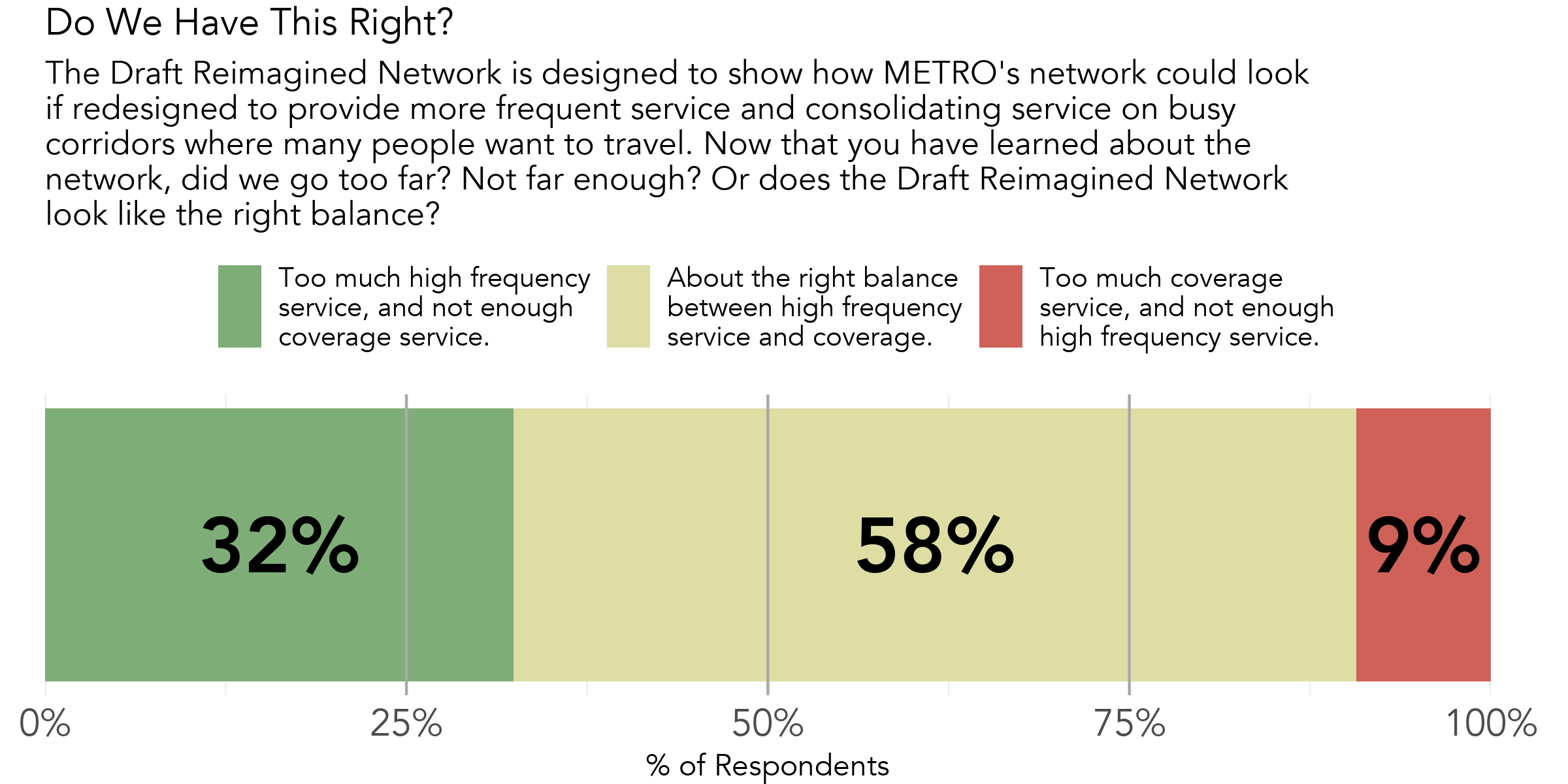
58% of respondents to METRO's survey said that the Draft Reimagined Network looked like the right balance of high frequency and coverage service . One third of respondents said that some of the coverage of the Existing Network should be restored.
What changed from the first draft?
The Draft Reimagined Network offers new high frequency service on METRO’s busiest corridors. With existing resources, it is not possible to offer that high frequency service and maintain service on every street where existing service runs The revised Reimagined Network includes several changes to address coverage impacts mentioned by respondents.
Based on the input received from stakeholders and the public, the revised design of the Reimagined Network only has minor modifications to the original draft. These changes, described below, were made to the Draft Reimained Network to address the coverage impacts survey respondents mentioned most frequently.
Route 8
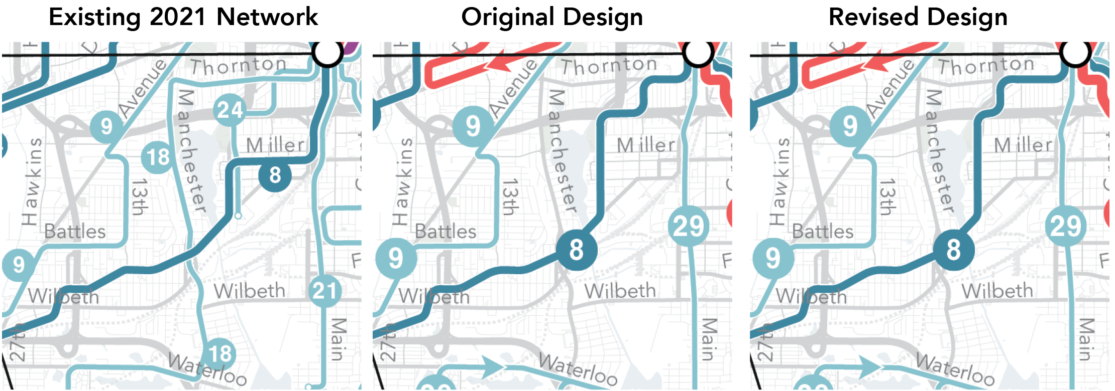
In the Draft Reimagined Network, Route 8 missed a segment of Thornton currently served every 60 minutes by Route 18. In the Reimagined Network, Route 8 would stay on Lake Shore Blvd/Boulevard St into Rhodes/Dart, then to Thornton to improve access for residents living in senior housing communities at Thornton and Dart.
Route 27
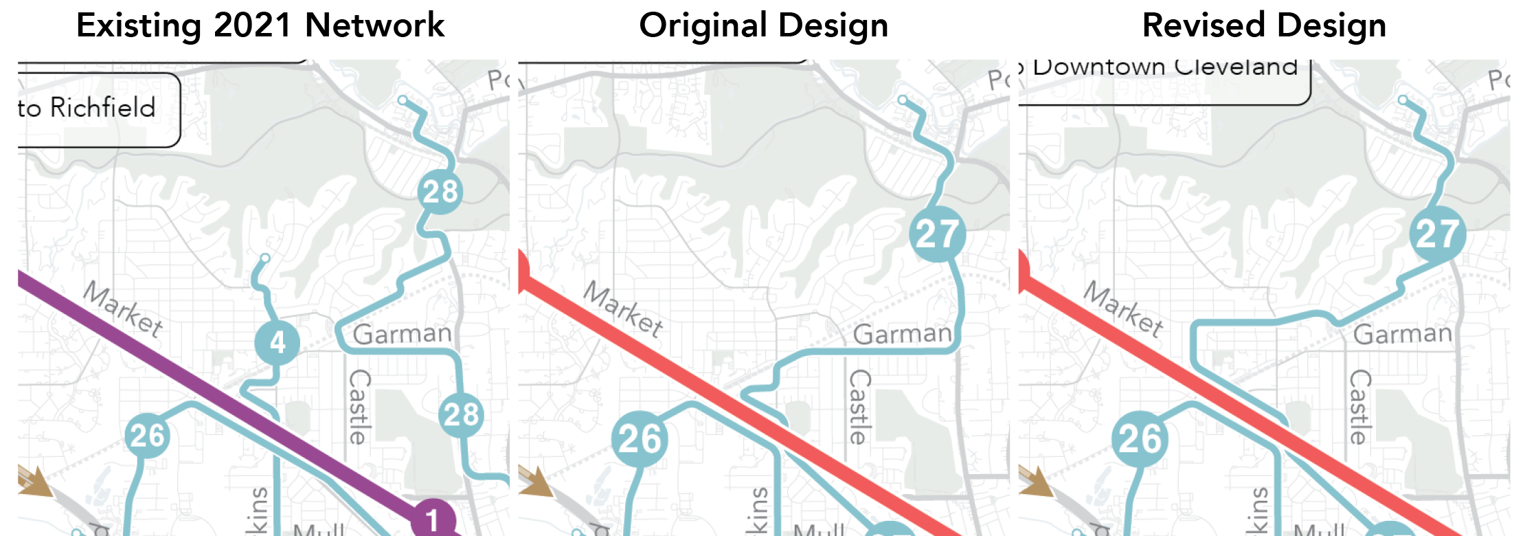
Route 27 serving Merriman Valley was adjusted to operate via Wiltshire and Fairfax, rather than along Bryden and Garman as in the Draft Reimagined Netwwork. This was done in order to better serve Firestone High School and the 7 Stories Apartments along Hawkins, as well as improve access for residents who live outside of walking distance to higher frequency service along West Market.
How did we design the Reimagined Network?
Creating a transit network capable of generating high ridership isn’t just about faster or more frequent service. To be useful to many people, fast, frequent service must be available in places where the development pattern supports its use.
The goals of METRO’s Strategic Plan propose a network that more accessible to current and future riders. To design that network, METRO evaluated a range of existing land use and network performance factors.
You can learn more about the design principles behind the Reimagined Network, and the performance of the Existing Network in the Operational Analysis Report.
Designing for High Ridership
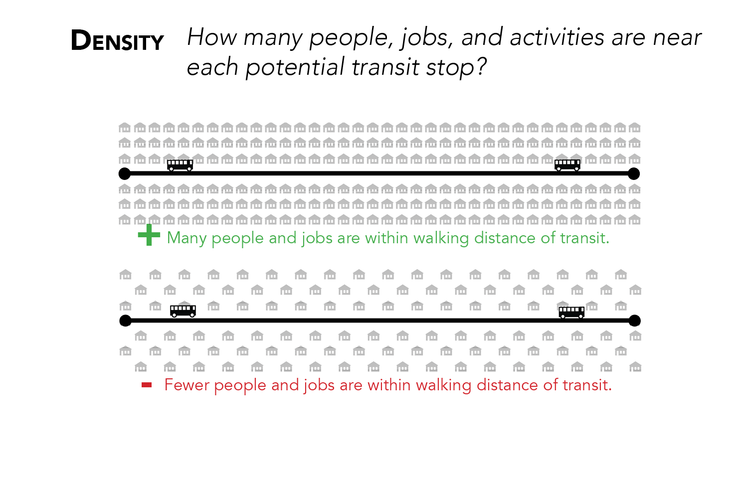
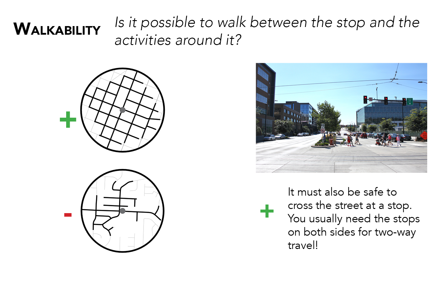
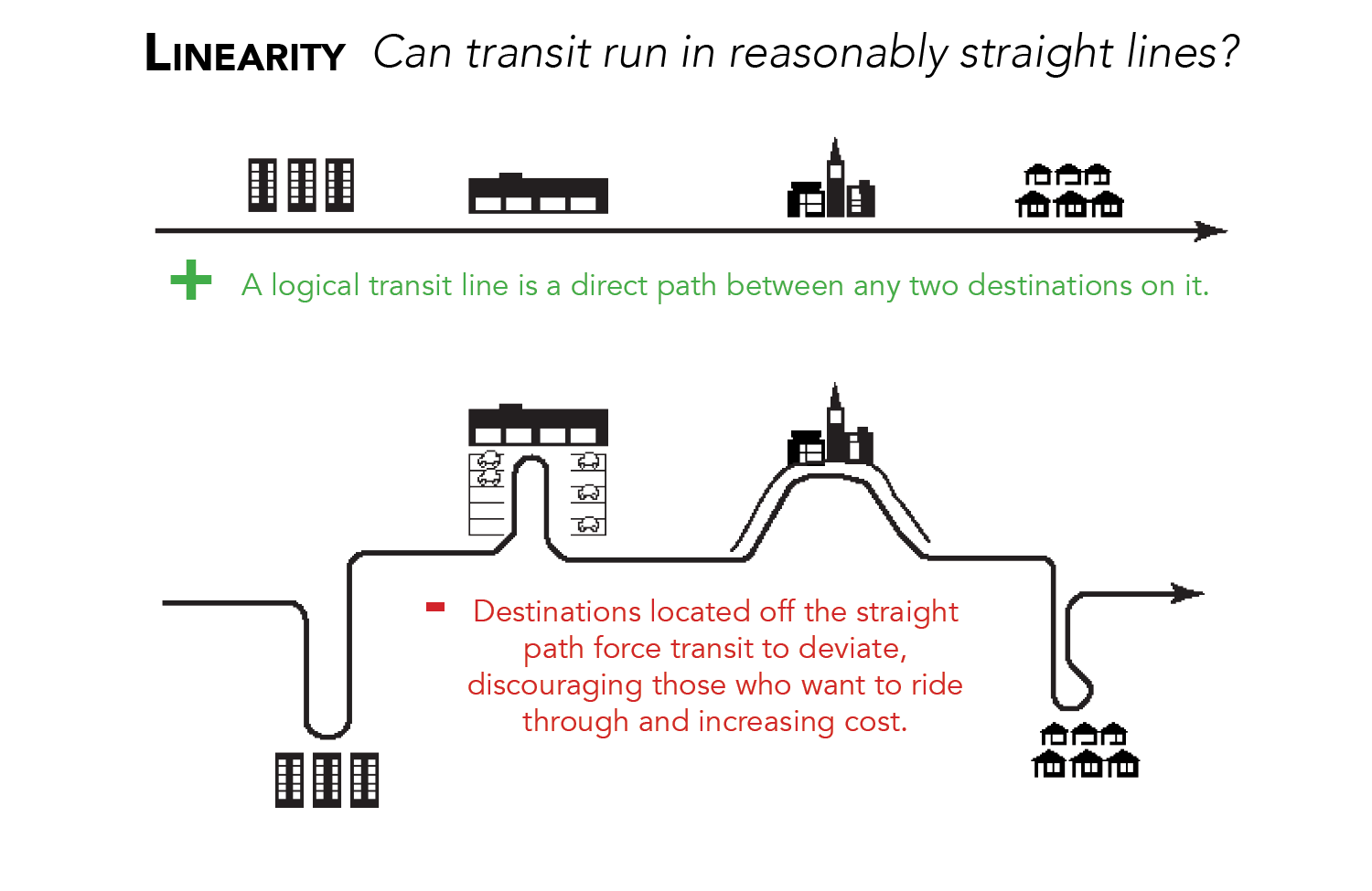
Density - where are more people nearby who could take transit?
The single most important factor in the design of a high-ridership transit network is density.
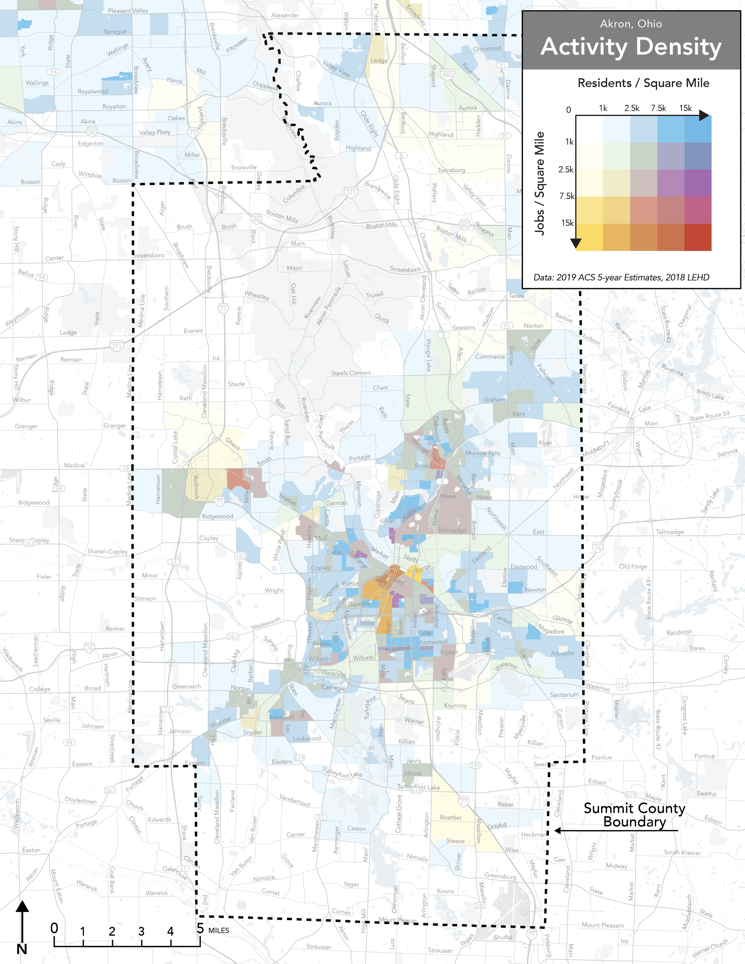
The map below shows the combination of population and employment density.
Residential density (where people live) is shown in shades of blue.
Job density (where people work) is shown in shades of yellow,
Mixed-use places where residents and jobs are both present are shown in shades of red.
The darker the color, the greater the number of jobs or residents in the area.
The Draft Reimagined Network is designed to make transit as useful as possible for travel to and from dense, busy places in Summit County.
Density determines the total size of the potential market for transit. How many people are near a bus stop who could make the choice to ride, or would benefit from a faster travel time?